 |
|
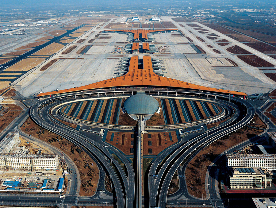
An aerial picture of Terminal 3 of the Beijing Capital International Airport taken in February 2008. [Photo provided to China Daily] |
In the early 2000s, he took up a publicity role for two major construction groups, and he came up with the idea of taking aerial photos from a helicopter, which later received the backing of the military, while he was looking for ways to present the progress made to the city's road infrastructure.
Back then, the construction of the fifth and sixth ring roads were about to be completed. Ma recalls photographing the Second Ring Road, which is about 30 km long, by bike and shooting the third and fourth ring roads by car. He eventually applied for permission to use a helicopter to shoot the fifth and sixth ring roads.
And a beltway extending more than 900 km that connects the capital with Tianjin and Hebei province-also known as the Seventh Ring Road or the G95 Highway-is now nearing completion.
According to media reports, the length of Beijing's operational highways reached 1,058 km by the end of 2018, almost the same distance as a flight from Beijing to Shanghai. In 1997, the capital's roads barely stretched to 150 km.
"I have now shot every part of the network of highways that have developed in the city over the past 18 years from the sky. We now have an integrated transport system that connects the urban districts with the suburbs and the nearby countryside," he says, adding that there were still many dead-end roads and narrow country lanes beyond the fourth and fifth ring roads at the turn of the century.