| Travel in China > Natural Scenery > Rivers |
|
|
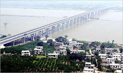
Huaihe River
The Huaihe River valley originates from the western Tongbai Mountain and reaches the eastern Huanghai Sea; its southern boundary consists of Dabie Mountains, the residual part of Wanshan Mountains and the Yangtze River reaches, and its northern boundary consists of the northern bank of the Yellow River, Yimong Mountains and the Yellow River reaches. The Huaihe River valley is located at China's transition terrain of northern climate and southern climate, so the connecting line of the Huaihe River, Qinling Mountains and the Bailong River has been the geographic boundary of the North and South China from of old.
The 382-kilometer long upper reaches of the Huaihe River mean the segment from the river source to the Honghekou Estuary located at the boundary of Henan and Anhui provinces. This segment of the Huaihe River runs across the mountainous regions and highlands, so it has the characteristics of mountainous stream, e.g. the current is rapid and the stream always suddenly rises and drops. The middle reaches of the Huaihe River are from the Honghekou Estuary to the outlet of the Hongze Lake in Jiangsu Province. The northern bank of the middle segment is one part of the Huanghuai Plain, and the southern bank is the Jianghuai Highland (the watershed of the Yangtze River valley and the Huaihe River valley). The lower reaches of the Huaihe River are from the outlet Zhongdu of Hongze Lake to the Biandan Port (Sanjiangying Port) of the Huanghai Sea. The total length of the Huaihe River from the source to the estuary Biandan Port is about 1,000 kilometers.
The whole Huaihe River Valley features a warm climate, fertile soil and rich products. It is China's earlier developed area in terms of economy and culture. |
||||||
All rights reserved. Reproduction of text for non-commercial purposes is permitted provided that both the source and author are acknowledged and a notifying email is sent to us. |
||||||
 |

