| Travel in China > Natural Scenery > Rivers |
|
|
Yangtze River
The Yangtze River (Changjiang), over 6,300 kilometers long, is the largest and longest river in China, and the third-longest in the world, next only to the Nile in northeast Africa and the Amazon in South America. The source of the Yangtze River lies to the west of Geladandong Mountain, the principal peak of the Tanggula Mountain chain in the Qinghai-Tibetan Plateau, southwest of China. The river flows from west to east through provinces of Qinghai, Tibet, Sichuan, Yunnan, Sichuan, Hubei, Hunan, Jiangxi, Anhui and Jiangsu as well as the city of Shanghai, finally emptying into the East China Sea. With plenty of rainfall all year round, the Yangtze River is named the golden watercourse.
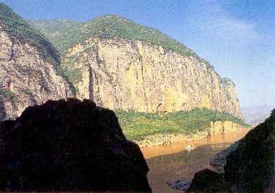
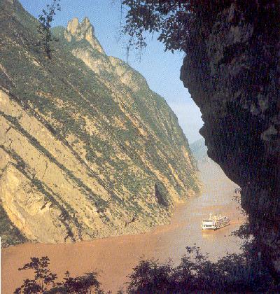
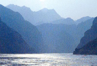
The most impressive section of the river is the three Yangtze River gorges: Qutang Gorge, Wuxia Gorge and Xiling Gorge, collectively known as Sanxia, or the Three Gorges.
There are many historical sites in Qutang Gorge. On a hilltop on the north bank are the town of Baidicheng, boasting many rare historical relics. On the south bank are the Whitewashed Wall covered with carved inscriptions, the legendary Meng Liang's Ladder, the Upside Down Monk, Armour Cave and the sweet-tasting Phoenix-Drinking Fountain in a deep cave. Also on the south bank, not far downstream, is a very strange-looking peak standing by the river; it is called the Rhinoceros Watching the Moon because it looks like a rhinoceros.
Noted for its deep and serene scenes, Wuxia Gorge is full of zigzag, weird peaks, rising mists and beautiful sights. The famous Twelve Peaks on both banks of the river, in particular, are the most spectacular. These strange-looking peaks are like a fairy maid dancing.
Wushan, Badong and Zigui are famous towns in the gorge. There are many famous historic sites too. The town of Zigui is attracting a large number of tourists because it is the native place of the great ancient poet Qu Yuan and the famous beautiful woman Wang Zhaojun.
The Daning River at the western entrance to Wuxia Gorge is flanked by continuous strange peaks, including Longmen, Bawu and Dicui, some of them rising into the clouds and presenting an unusual spectacle. The section of the river becomes known as the Minor Three Gorges.
Xiling Gorge is known for dangerous rapids and numerous shoals, the latter including the Qingtan, Kongling and Xietan shoals. These shoals were formed out of fallen and rock from banks, boulders and sands washed down from the upper reaches, veins protruding from the riverbanks, or reefs jutting out of the riverbed. At some points there are treacherous whirlpools and the waters are extraordinarily turbulent.
The Yangtze River Valley abounds in natural resources, for instance, mountains like Lingyun, Emei, Qingcheng, Hengshan, Shen Nongjia, Wudang, Lushan, Jinggang, Jiuhua, Huangshan and Mogan, rivers like Minjiang, Jialing, Daning, Qingjiang, Xiangjiang, the Grand Canal, and lakes like Dianchi, Dongting, Honghu, Poyang and Taihu, etc. |
||||||||
All rights reserved. Reproduction of text for non-commercial purposes is permitted provided that both the source and author are acknowledged and a notifying email is sent to us. |
||||||||
 |
 Qutang
Gorge
 Wuxia Gorge

 Xiling
Gorge