| Map |
|
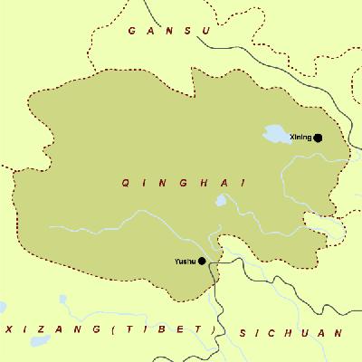
Qinghai Geography Geography
Qinghai has a continental climate. The greater part of it is dry and cold and with long winters, short summers, frequent winds, little rainfall, long hours of sunshine and great differences in temperature between day and night. It has a mean annual temperature of 0-8oC -- the hottest month, July, averaging 0-20oC and the coldest month, January, below -8oC -- and a mean annual precipitation generally below 300 mm.
It is divided into 1 prefecture-level city, 1 district, 6 autonomous prefectures, 2 county-level cities, 30 counties and 7 autonomous counties, with a population of 5.18 million as of 2000, mainly including ethnic groups of Han, Tibetan, Mongolian, Hui, Tu, Salar and Kazak. Minorities take up 39% of the local population.
The most famously Qinghai dishes include the Chinese Caterpillar Fungus (Dongchong Xiacao), Chrysanthemum Carp (Li Yu), Flagelliform Nostoc (Facai), Soup Cooked with Lamb and Oxen Entrails (Zasui Tang) and various forms of local mushroom.
The minorities living in Qinghai love singing and dancing, which has distinctive ethical characteristics.
Qinghai Province is called Qing for short. The province lies in the upper reaches of the Yangtze and the Yellow river valleys in the southern part of northwestern China. It officially got the present name in 1928. Qinghai is the origin of the Yangtze and Yellow rivers, abundant in river branches, streams, lakes as well as wildlife resources. The Qinghai Lake is the largest salt lake in China.
Its major industries are petroleum, natural gas, chemical, and textile. Agriculture and stockbreeding are the mainstay of Qinghai's economy.
Qinghai is a sparking jewel set on the northwest plateau of China. It is at the source of the rivers in Himalayas, wherein the Yangtze River and Yellow River as well as the Lancang (Mekong) River take their source.
The scenic quality of Qinghai's widely varying landscape is superb and enticing, offering from the ranges of gleaming mountains with glacier-capped peaks over 6,000 meters high to the Gobi desert dunes of Qaidam, from lush ranch land to the sapphire-like lakes of vast area, all this has created a land of marvel, mystery and diversity.
The Qinghai Lake is a photographer and artist's paradise of mirrored pastel sunrises, azure beauty in midday and the indigo blues of sunset. The Bird Island, called "the Kingdom of Birds", on the western tip hosts hundreds of thousand migratory birds, hovering over the sky or diving into the water. In April, tens of thousands of brown-headed gulls, cormorants, and swan come from South China, Southeast Asia and other places to multiply here.
The Qaidam, once been prosperous as the ancient Silk Road stretching across much of its length, is an idea place for expedition. You can explore the End of the World, mystic Lost City and discover the beauty of dazzling salt lakes.
As it is one of China's six biggest lamaseries of the yellow sect and the birthplace of its founder, Tsong Khapa, the Taer Lamasery is a fine combination of Han and Tibetan architecture covering an area of more than 40 hectares. The original construction began in the 39th year of the Jiajing reign (1560) of the Ming Dynasty (1368-1644) and the lamasery now consists of the Great Temple of Golden Tile, the Lesser Temple of Golden Tile, the Great Meditation Hall, Eight Stupas, the Longevity Temple and the Nine Room Hall, to mention a few. The butter sculptures, murals and appliqués are known as its unique "three wonders" of art. |
||||
 |